Ocean and Coastal Exploration and NOAA Act (OCEAN Act)
A bill to establish a coordinated national ocean exploration program within the National Oceanic and Atmospheric Administration, and for other purposes.
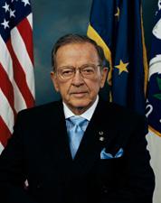 Sen. Ted Stevens (R-AK)
Legislative Activity
Stay on top of the latest movement without scrolling through every action
Placed on Senate Legislative Calendar under General Orders. Calendar No. 90.
March 27, 2007
View full timeline
Introduced in Senate
January 4, 2007
Read twice and referred to the Committee on Commerce, Science, and Transportation.
January 4, 2007
Committee on Commerce, Science, and Transportation. Ordered to be reported with an amendment in the nature of a substitute favorably.
February 13, 2007
Committee on Commerce, Science, and Transportation. Reported by Senator Inouye with an amendment in the nature of a substitute. With written report No. 110-39.
March 27, 2007
Placed on Senate Legislative Calendar under General Orders. Calendar No. 90.
March 27, 2007
Floor Debate
1 memberWhat members said about S. 39 on the floor
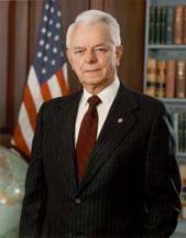
Floor Debate
1 memberWhat members said about S. 39 on the floor
Mr. President, to many Americans, the word ``Vietnam'' has become a painful remainder of a bloody quagmire of a never-ending war without an exit strategy. Certainly, Vietnam is a reminder of failed…
Mr. President, I ask unanimous consent that the Committee on Agriculture, Nutrition and Forestry be authorized to conduct a hearing during the session of the Senate on Tuesday, February 13, 2007, at…
Bill Text
2 versions available
        [Congressional Bills 110th Congress]
[From the U.S. Government Publishing Office]
[S. 39 Reported in Senate (RS)]

Calendar No. 90
110th CONGRESS
1st Session
S. 39

[Report No. 110-39]

To establish a coordinated national ocean exploration program within
the National Oceanic and Atmospheric Administration, and for other
purposes.

_______________________________________________________________________

IN THE SENATE OF THE UNITED STATES

January 4, 2007

Mr. Stevens introduced the following bill; which was read twice and
referred to the Committee on Commerce, Science, and Transportation

March 27, 2007

Reported by Mr. Inouye, with an amendment
[Strike out all after the enacting clause and insert the part printed
in italic]

_______________________________________________________________________

A BILL

To establish a coordinated national ocean exploration program within
the National Oceanic and Atmospheric Administration, and for other
purposes.

Be it enacted by the Senate and House of Representatives of the
United States of America in Congress assembled,

SECTION 1. SHORT TITLE; TABLE OF CONTENTS.

(a) Short Title.--This Act may be cited as the ``Ocean and Coastal
Exploration and NOAA Act (OCEAN Act)''.
(b) Table of Contents.--The table of contents for this Act is as
follows:

Sec. 1. Short title; table of contents.

TITLE I--NATIONAL OCEAN EXPLORATION PROGRAM

Sec. 101. Short title.
Sec. 102. Establishment.
Sec. 103. Authorities.
Sec. 104. Exploration technology and infrastructure task force.
Sec. 105. Interagency financing.
Sec. 106. Authorization of appropriations.

TITLE II--UNDERSEA RESEARCH PROGRAM

Sec. 201. Short title.
Sec. 202. Establishment.
Sec. 203. Purpose.
Sec. 204. Program.
Sec. 205. Regional centers and technology institute.
Sec. 206. Competitiveness.
Sec. 207. Authorization of appropriations.

TITLE III--OCEAN AND COASTAL MAPPING INTEGRATION

Sec. 301. Short title.
Sec. 302. Integrated ocean and coastal mapping program.
Sec. 303. Interagency Committee on ocean and coastal mapping.
Sec. 304. NOAA integrated mapping initiative.
Sec. 305. Interagency program reporting.
Sec. 306. Authorization of appropriations.
Sec. 307. Definitions.

TITLE I--NATIONAL OCEAN EXPLORATION PROGRAM

SEC. 101. SHORT TITLE.

This title may be cited as the ``National Ocean Exploration Program
Act''.

SEC. 102. ESTABLISHMENT.

The Secretary of Commerce, through the Administrator of the
National Oceanic and Atmospheric Administration, shall, in consultation
with the National Science Foundation and other appropriate Federal
agencies, establish a coordinated national ocean exploration program
within the National Oceanic and Atmospheric Administration that
promotes collaboration with existing programs of the agency, including
those authorized in title II.

SEC. 103. AUTHORITIES.

In carrying out the program the Administrator of the National
Oceanic and Atmospheric Administration shall--
(1) conduct interdisciplinary exploration voyages or other
scientific activities in conjunction with other Federal
agencies or academic or educational institutions, to survey
little known areas of the marine environment, inventory,
observe, and assess living and nonliving marine resources, and
report such findings;
(2) give priority attention to deep ocean regions, with a
focus on surveying deep water marine systems that hold
potential for important scientific discoveries, such as
hydrothermal vent communities and seamounts;
(3) conduct scientific voyages to locate, define, and
document historic shipwrecks, submerged sites, and other ocean
exploration activities that combine archaeology and
oceanographic sciences;
(4) develop, in consultation with the National Science
Foundation, a transparent process for reviewing and approving
proposals for activities to be conducted under this program;
(5) enhance the technical capability of the United States
marine science community by promoting the development of
improved oceanographic research, communication, navigation, and
data collection systems, as well as underwater platforms and
sensors;
(6) accept donations of property, data, and equipment to be
applied for the purpose of exploring the oceans or increasing
knowledge of the oceans; and
(7) establish an ocean exploration forum to encourage
partnerships and promote communication among experts and other
stakeholders in order to enhance the scientific and technical
expertise and relevance of the national program.

SEC. 104. EXPLORATION TECHNOLOGY AND INFRASTRUCTURE TASK FORCE.

The National Oceanic and Atmospheric Administration, in
coordination with the National Aeronautics and Space Administration,
the U.S. Geological Survey, Office of Naval Research, and relevant
governmental, non-governmental, academic, and other experts, shall
convene an ocean technology and infrastructure task force to develop
and implement a strategy--
(1) to facilitate transfer of new exploration technology to
the program;
(2) to improve availability of communications
infrastructure, including satellite capabilities, to the
program;
(3) to develop an integrated, workable and comprehensive
data management information processing system that will make
information on unique and significant features obtained by the
program available for research and management purposes;
(4) to conduct public outreach activities that improve the
public understanding of ocean science, resources, and
processes, in conjunction with relevant programs of the
National Oceanic and Atmospheric Administration, the National
Science Foundation, and other agencies; and
(5) to encourage cost-sharing partnerships with
governmental and non-governmental entities that will assist in
transferring exploration technology and technical expertise to
the program.

SEC. 105. INTERAGENCY FINANCING.

The National Oceanic and Atmospheric Administration, the National
Science Foundation, and other Federal agencies involved in the program,
are authorized to participate in interagency financing and share,
transfer, receive and spend funds appropriated to any Federal
participant in the program for the purposes of carrying out any
administrative or programmatic project or activity under this section.
Funds may be transferred among such departments and agencies through an
appropriate instrument that specifies the goods, services, or space
being acquired from another Federal participant and the costs of the
same.

SEC. 106. AUTHORIZATION OF APPROPRIATIONS.

There are authorized to be appropriated to the National Oceanic and
Atmospheric Administration to carry out the program--
(1) $30,500,000 for fiscal year 2008;
(2) $33,550,000 for fiscal year 2009;
(3) $36,905,000 for fiscal year 2010;
(4) $40,596,000 for fiscal year 2011;
(5) $44,655,000 for fiscal year 2012;
(6) $49,121,000 for fiscal year 2013;
(7) $54,033,000 for fiscal year 2014;
(8) $59,436,000 for fiscal year 2015;
(9) $65,379,000 for fiscal year 2016; and
(10) $71,917,000 for fiscal year 2017.

TITLE II--UNDERSEA RESEARCH PROGRAM

SEC. 201. SHORT TITLE.

This title may be cited as the ``NOAA Undersea Research Program Act
of 2007''.

SEC. 202. ESTABLISHMENT.

The Administrator of the National Oceanic and Atmospheric
Administration shall establish and maintain an undersea research
program and shall designate a Director of that program.

SEC. 203. PURPOSE.

The purpose of the program is to increase scientific knowledge
essential for the informed management, use and preservation of oceanic,
coastal and large lake resources through undersea research,
exploration, education and technology development. The program shall be
part of National Oceanic and Atmospheric Administration's undersea
research, education, and technology development efforts, and also make
available the infrastructure and expertise to service the undersea
science needs of the academic community.

SEC. 204. PROGRAM.

The program shall be conducted through a national headquarters, a
network of regional undersea research centers, and a national
technology institute. Overall direction of the program will be provided
by the program director with advice from the Council of Center
directors comprised of the directors of the regional centers and the
national technology institute.

SEC. 205. REGIONAL CENTERS AND TECHNOLOGY INSTITUTE.

The following research, exploration, education, and technology
programs shall be conducted through the network of regional centers and
the national technology institute:
(1) Core research and exploration based on national and
regional undersea research priorities.
(2) Advanced undersea technology to support the National
Oceanic and Atmospheric Administration's research mission and
programs.
(3) Undersea science-based education and outreach programs
to enrich ocean science education and public awareness of the
oceans and Great Lakes.
(4) Development of advanced undersea technology associated
with seafloor observatories, remotely operated vehicles,
autonomous underwater vehicles, and new sampling and sensing
technologies.
(5) Discovery, study, and development of natural products
from ocean and aquatic systems.
(6) Discovery, study, monitoring, and evaluation of United
States ocean and coastal resources, such as wave, current,
tidal, and biological resources.

SEC. 206. COMPETITIVENESS.

Except for a small discretionary fund for rapid response activities
and for the National Oceanic and Atmospheric Administration-related
service projects, for which no more than 10 percent of the program
budget shall be set aside, the external projects supported by the
regional centers shall be managed using an open and competitive process
to evaluate scientific merit, relevance to the National Oceanic and
Atmospheric Administration, regional and national research goals, and
technical feasibility.

SEC. 207. AUTHORIZATION OF APPROPRIATIONS.

There are authorized to be appropriated to the National Oceanic and
Atmospheric Administration--
(1) for fiscal year 2008--
(A) $12,500,000 for the regional centers, of which
50 percent shall be for West Coast regional centers and
50 percent shall be for East Coast regional centers;
and
(B) $5,000,000 for the National Technology
Institute;
(2) for fiscal year 2009--
(A) $13,750,000 for the regional centers, of which
50 percent shall be for West Coast regional centers and
50 percent shall be for East Coast regional centers;
and
(B) $5,500,000 for the National Technology
Institute;
(3) for fiscal year 2010--
(A) $15,125,000 for the regional centers, of which
50 percent shall be for West Coast regional centers and
50 percent shall be for East Coast regional centers;
and
(B) $6,050,000 for the National Technology
Institute;
(4) for fiscal year 2011--
(A) $16,638,000 for the regional centers, of which
50 percent shall be for West Coast regional centers and
50 percent shall be for East Coast regional centers;
and
(B) $6,655,000 for the National Technology
Institute;
(5) for fiscal year 2012--
(A) $18,301,000 for the regional centers, of which
50 percent shall be for West Coast regional centers and
50 percent shall be for East Coast regional centers;
and
(B) $7,321,000 for the National Technology
Institute;
(6) for fiscal year 2013--
(A) $20,131,000 for the regional centers, of which
50 percent shall be for West Coast regional centers and
50 percent shall be for East Coast regional centers;
and
(B) $8,053,000 for the National Technology
Institute;
(7) for fiscal year 2014--
(A) $22,145,000 for the regional centers, of which
50 percent shall be for West Coast regional centers and
50 percent shall be for East Coast regional centers;
and
(B) $8,859,000 for the National Technology
Institute;
(8) for fiscal year 2015--
(A) $24,359,000 for the regional centers, of which
50 percent shall be for West Coast regional centers and
50 percent shall be for East Coast regional centers;
and
(B) $9,744,000 for the National Technology
Institute;
(9) for fiscal year 2016--
(A) $26,795,000 for the regional centers, of which
50 percent shall be for West Coast regional centers and
50 percent shall be for East Coast regional centers;
and
(B) $10,718,000 for the National Technology
Institute; and
(10) for fiscal year 2017--
(A) $29,474,000 for the regional centers, of which
50 percent shall be for West Coast regional centers and
50 percent shall be for East Coast regional centers;
and
(B) $11,790,000 for the National Technology
Institute.

TITLE III--OCEAN AND COASTAL MAPPING INTEGRATION

SEC. 301. SHORT TITLE.

This title may be cited as the ``Ocean and Coastal Mapping
Integration Act''.

SEC. 302. INTEGRATED OCEAN AND COASTAL MAPPING PROGRAM.

(a) In General.--The Administrator of the National Oceanic and
Atmospheric Administration shall establish a program to develop, in
coordination with the Interagency Committee on Ocean and Coastal
Mapping, a coordinated and comprehensive Federal ocean and coastal
mapping plan for the Great Lakes and Coastal State waters, the
territorial sea, the exclusive economic zone, and the continental shelf
of the United States that enhances ecosystem approaches in decision-
making for conservation and management of marine resources and
habitats, establishes research priorities, supports the siting of
research and other platforms, and advances ocean and coastal science.
(b) Program Parameters.--In developing such a program, the
Administrator shall work with the Committee to--
(1) identify all Federal and federally-funded programs
conducting shoreline delineation and ocean or coastal mapping,
noting geographic coverage, frequency, spatial coverage,
resolution, and subject matter focus of the data and location
of data archives;
(2) promote cost-effective, cooperative mapping efforts
that incorporate policies for private sector contracting among
all Federal agencies conducting ocean and coastal mapping
agencies by increasing data sharing, developing data
acquisition and metadata standards, and facilitating the
interoperability of in situ data collection systems, data
processing, archiving, and distribution of data products;
(3) facilitate the adaptation of existing technologies as
well as foster expertise in new ocean and coastal mapping
technologies, including through research, development, and
training conducted in cooperation with the private sector,
academia, and other non-Federal entities;
(4) develop standards and protocols for testing innovative
experimental mapping technologies and transferring new
technologies between the Federal Government and the private
sector or academia;
(5) centrally archive, manage, and distribute data sets as
well as provide mapping products and services to the general
public in service of statutory requirements;
(6) develop specific data presentation standards for use by
Federal, State, and other entities that document locations of
federally-permitted activities, living and nonliving resources,
marine ecosystems, sensitive habitats, submerged cultural
resources, undersea cables, offshore aquaculture projects, and
any areas designated for the purposes of environmental
protection or conservation and management of living marine
resources; and
(7) identify the procedures to be used for coordinating
Federal data with State and local government programs.

SEC. 303. INTERAGENCY COMMITTEE ON OCEAN AND COASTAL MAPPING.

(a) Establishment.--There is hereby established an Interagency
Committee on Ocean and Coastal Mapping.
(b) Membership.--The Committee shall be comprised of senior
representatives from Federal agencies with ocean and coastal mapping
and surveying responsibilities. The representatives shall be high-
ranking officials of their respective agencies or departments and,
whenever possible, the head of the portion of the agency or department
that is most relevant to the purposes of this title. Membership shall
include senior representatives from the National Oceanic and
Atmospheric Administration, the Chief of Naval Operations, the United
States Geological Survey, Minerals Management Service, National Science
Foundation, National Geospatial-Intelligence Agency, United States Army
Corps of Engineers, United States Coast Guard, Environmental Protection
Agency, Federal Emergency Management Agency and National Aeronautics
and Space Administration, and other appropriate Federal agencies
involved in ocean and coastal mapping.
(c) Chairman.--The Committee shall be chaired by the representative
from the National Oceanic and Atmospheric Administration. The chairman
may create subcommittees chaired by any member agency of the committee.
Working groups may be formed by the full Committee to address issues of
short duration.
(d) Meetings.--The Committee shall meet on a quarterly basis, but
subcommittee or working group meetings shall meet on an as-needed
basis.
(e) Coordination.--The committee shall coordinate activities, when
appropriate, with--
(1) other Federal efforts, including the Digital Coast,
Geospatial One-Stop, and the Federal Geographic Data Committee;
(2) international mapping activities;
(3) States and user groups through workshops and other
appropriate mechanisms; and
(4) representatives of the private sector.

SEC. 304. NOAA INTEGRATED MAPPING INITIATIVE.

(a) In General.--Not later than 6 months after the date of
enactment of this Act, the Administrator, in consultation with the
Committee, shall develop and submit to the Congress a plan for an
integrated ocean and coastal mapping initiative within the National
Oceanic and Atmospheric Administration.
(b) Plan Requirements.--The plan shall--
(1) identify and describe all ocean and coastal mapping
programs within the agency, including those that conduct
mapping or related activities in the course of existing
missions, such as hydrographic surveys, ocean exploration
projects, living marine resource conservation and management
programs, coastal zone management projects, and ocean and
coastal science projects;
(2) establish priority mapping programs and establish and
periodically update priorities for geographic areas in
surveying and mapping, as well as minimum data acquisition and
metadata standards for those programs;
(3) encourage the development of innovative ocean and
coastal mapping technologies and applications through research
and development through cooperative or other agreements at
joint centers of excellence and with the private sector;
(4) document available and developing technologies, best
practices in data processing and distribution, and leveraging
opportunities with other Federal agencies, non-governmental
organizations, and the private sector;
(5) identify training, technology, and other resource
requirements for enabling the National Oceanic and Atmospheric
Administration's programs, ships, and aircraft to support a
coordinated ocean and coastal mapping program;
(6) identify a centralized mechanism or office for
coordinating data collection, processing, archiving, and
dissemination activities of all such mapping programs within
the National Oceanic and Atmospheric Administration,
including--
(A) designating primary data processing centers to
maximize efficiency in information technology
investment, develop consistency in data processing, and
meet Federal mandates for data accessibility; and
(B) designating a repository that is responsible
for archiving and managing the distribution of all
ocean and coastal mapping data to simplify the
provision of services to benefit Federal and State
programs; and
(7) set forth a timetable for implementation and completion
of the plan, including a schedule for periodic Congressional
progress reports, and recommendations for integrating
approaches developed under the initiative into the interagency
program.
(c) NOAA Joint Ocean and Coastal Mapping Centers.--The
Administrator is authorized to maintain and operate up to 3 joint ocean
and coastal mapping centers, including a joint hydrographic center,
which shall be co-located with an institution of higher education. The
centers shall serve as hydrographic centers of excellence and are
authorized to conduct activities necessary to carry out the purposes of
this title, including--
(1) research and development of innovative ocean and
coastal mapping technologies, equipment, and data products;
(2) mapping of the United States outer continental shelf;
(3) data processing for non-traditional data and uses;
(4) advancing the use of remote sensing technologies, for
related issues, including mapping and assessment of essential
fish habitat and of coral resources, ocean observations and
ocean exploration; and
(5) providing graduate education in ocean and coastal
mapping sciences for National Oceanic and Atmospheric
Administration Commissioned Officer Corps, personnel of other
agencies with ocean and coastal mapping programs, and civilian
personnel.
(d) NOAA Report.--The Administrator shall continue developing a
strategy for expanding contracting with private entities to minimize
duplication and take maximum advantage of private sector capabilities
in fulfilling the Administration's mapping and charting
responsibilities. Within 120 days after the date of enactment of this
Act, the Administrator shall transmit a report describing the strategy
developed under this subsection to the Senate Committee on Commerce,
Science, and Transportation and the House of Representatives Committee
on Resources.

SEC. 305. INTERAGENCY PROGRAM REPORTING.

No later than 18 months after the date of enactment of this Act,
and bi-annually thereafter, the Chairman of the Committee shall
transmit to the Senate Committee on Commerce, Science, and
Transportation and the House of Representatives Committee on Resources
a report detailing progress made in implementing the provisions of this
title, including--
(1) an inventory of ocean and coastal mapping data, noting
the metadata, within the territorial seas and the exclusive
economic zone and throughout the continental shelf of the
United States, noting the age and source of the survey and the
spatial resolution (metadata) of the data;
(2) identification of priority areas in need of survey
coverage using present technologies;
(3) a resource plan that identifies when priority areas in
need of modern ocean and coastal mapping surveys can be
accomplished;
(4) the status of efforts to produce integrated digital
maps of ocean and coastal areas;
(5) a description of any products resulting from
coordinated mapping efforts under this title that improve
public understanding of the coasts, oceans, or regulatory
decision-making;
(6) documentation of minimum and desired standards for data
acquisition and integrated metadata;
(7) a statement of the status of Federal efforts to
leverage mapping technologies, coordinate mapping activities,
share expertise, and exchange data;
(8) a statement of resource requirements for organizations
to meet the goals of the program, including technology needs
for data acquisition, processing and distribution systems;
(9) a statement of the status of efforts to declassify data
gathered by the Navy, the National Geospatial-Intelligence
Agency and other agencies to the extent possible without
jeopardizing national security, and make it available to
partner agencies and the public; and
(10) a resource plan for a digital coast integrated mapping
pilot project for the northern Gulf of Mexico that will--
(A) cover the area from the authorized coastal
counties through the territorial sea;
(B) identify how such a pilot project will leverage
public and private mapping data and resources, such as
the United States Geological Survey National Map, to
result in an operational coastal change assessment
program for the subregion;
(11) the status of efforts to coordinate Federal programs
with State and local government programs and leverage those
programs; and
(12) describes efforts of Federal agencies to increase
private sector contracting.

SEC. 306. AUTHORIZATION OF APPROPRIATIONS.

(a) In General.--In addition to the amounts authorized by section
306 of the Hydrographic Services Improvement Act of 1998 (33 U.S.C.
892d), there are authorized to be appropriated to the Administrator to
carry out this title--
(1) $20,000,000 for fiscal year 2008;
(2) $26,000,000 for fiscal year 2009;
(3) $32,000,000 for fiscal year 2010;
(4) $38,000,000 for fiscal year 2011; and
(5) $45,000,000 for each of fiscal years 2012 through 2015.
(b) Joint Ocean and Coastal Mapping Centers.--Of the amounts
appropriated pursuant to subsection (a), the following amounts shall be
used to carry out section 304(c) of this title:
(1) $10,000,000 for fiscal year 2008.
(2) $11,000,000 for fiscal year 2009.
(3) $12,000,000 for fiscal year 2010.
(4) $13,000,000 for fiscal year 2011.
(5) $15,000,000 for each of fiscal years 2012 through 2015.
(c) Interagency Committee.--Notwithstanding any other provision of
law, from amounts authorized to be appropriated for fiscal years 2008
through 2015 to the Department of Defense, the Department of the
Interior, the Department of Homeland Security, the Environmental
Protection Agency, and the National Aeronautics and Space
Administration, the head of each such department or agency may make
available not more than $10,000,000 per fiscal year to carry out
interagency activities under section 303 of this title.

SEC. 307. DEFINITIONS.

In this title:
(1) Administrator.--The term ``Administrator'' means the
Administrator of the National Oceanic and Atmospheric
Administration.
(2) Coastal state.--The term ``coastal state'' has the
meaning given that term by section 304(4) of the Coastal Zone
Management Act of 1972 (16 U.S.C. 1453(4).
(3) Committee.--The term ``Committee'' means the
Interagency Ocean Mapping Committee established by section 303.
(4) Exclusive economic zone.--The term ``exclusive economic
zone'' means the exclusive economic zone of the United States
established by Presidential Proclamation No. 5030, of March 10,
1983.
(5) Ocean and coastal mapping.--The term ``ocean and
coastal mapping'' means the acquisition, processing, and
management of physical, biological, geological, chemical, and
archaeological characteristics and boundaries of ocean and
coastal areas, resources, and sea beds through the use of
acoustics, satellites, aerial photogrammetry, light and
imaging, direct sampling, and other mapping technologies.
(6) Territorial sea.--The term ``territorial sea'' means
the belt of sea measured from the baseline of the United States
determined in accordance with international law, as set forth
in Presidential Proclamation Number 5928, dated December 27,
1988.
Calendar No. 90

110th CONGRESS

1st Session

S. 39

[Report No. 110-39]

_______________________________________________________________________

A BILL

To establish a coordinated national ocean exploration program within
the National Oceanic and Atmospheric Administration, and for other
purposes.

_______________________________________________________________________

March 27, 2007

Reported with an amendment